
| February 2001 | ||||||
| Sun | Mon | Tue | Wed | Thu | Fri | Sat |
| 1 | 2 | 3 | ||||
| 4 | 5 | 6 | 7 | 8 | 9 | 10 |
| 11 | 12 | 13 | 14 | 15 | 16 | 17 |
| 18 | 19 | 20 | 21 | 22 | 23 | 24 |
| 25 | 26 | 27 | 28 | |||
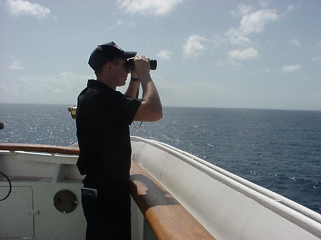
At 0800 Central Standard Time, the Training Ship Empire State was located at 29 degrees and 23 minutes N Latitude, 087 degrees and 17 minutes W Longitude. Pensacola Bay was 42 nautical miles to the North. She was steering course 000 degrees true at a speed of 16 knots, approaching the outer anchorage of Pensacola, Florida. The air temperature was 68 degrees and water temperature 72 degrees Fahrenheit; skies were hazy with 100 percent relative humidity; winds were from the Southeast at 03 knots; barometric pressure was 1018 millibars and rising. Seas were gently rolling at 2 to 4 feet. Depth of water beneath the keel was 290 feet
CAPTAIN'S LOG
We must go beyond textbooks, go out into the bypaths and untrodden depths of the wilderness and travel and explore and tell the world the glories of our journey. --John Hope Franklin, 1967
After a foggy start, our southbound salsa proceeded perfectly; the Bar Pilot waved good-by at 1730, we took departure, and happily watched the Fathometer trace the muddy bottom in rapid retreat. How do you spell relief...Gulf of Mexico!
We steered southeast into safe water and reviewed today's training plan while calmly reacquainting the Watch Sections with the at sea routines. A full day of piloting the Mississippi is draining and the strain of it was evident. The Cadets slept especially well last night due in large part to the ambitious liberty schedules that they kept. But our newly repaired air conditioning units helped too; Thank goodness! We are enjoying cooler temperatures in these latitudes but the atmosphere is absolutely saturated. Without the cooling coils, the berthing compartments would likely generate their own monsoonal weather patterns and misery, indeed.
So after a rest filled night, we are moving quickly northward this morning, and we intent to use the entire day to teach the art and science of anchoring. The outer anchorage at Pensacola, Florida is perfect; the water is shallow, the area is well protected, and we shan't freeze to the anchor windless out on the foredeck.
Dropping anchor appears to those watching from the beach, little more than gravity in action. But, that is far from reality. When one hears, "Let Go Forward" those three little words mask hours of work and sweat. Anchoring is a skilled operation that requires precise navigation, split second timing, and exacting communications among all concerned.
First, the Cadets must plan the evolutions on paper. The Cadet Navigator selects the appropriate charts and locates the intended anchorage. Then he or she reviews the ship's design characteristics to be absolutely certain that the ship will safely fit into the intended space. (i.e., water depth, distance to the beach, or other moorings, etc.) Tides are calculated and prevailing harbor currents and wind speeds plotted in order to determine set and drift. All the resulting data is recorded on the geographic plot and navigation charts before the approach to the anchorage can begin.
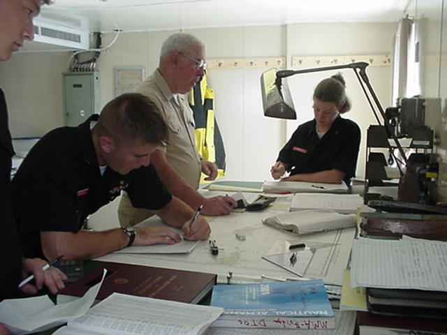
The approach itself, is demanding and the Cadet Navigator must fix the ships position at very close intervals along the intended track. Knowing where the ship is located is important but knowing where it will be is crucial. The Cadet Officer of the Deck must use this information to time commands given to the entire Ship Control Party. If all work together, 17,000 tons of steel hustles smartly down the intended track, comes to all stop on the dime, and sets the anchor on the bottom, dead center of the charted mooring. If not, well its wheels up and around we go. Sounds easy, doesn't it? If you think so, try circling a sixteen wheeler in the driveway.
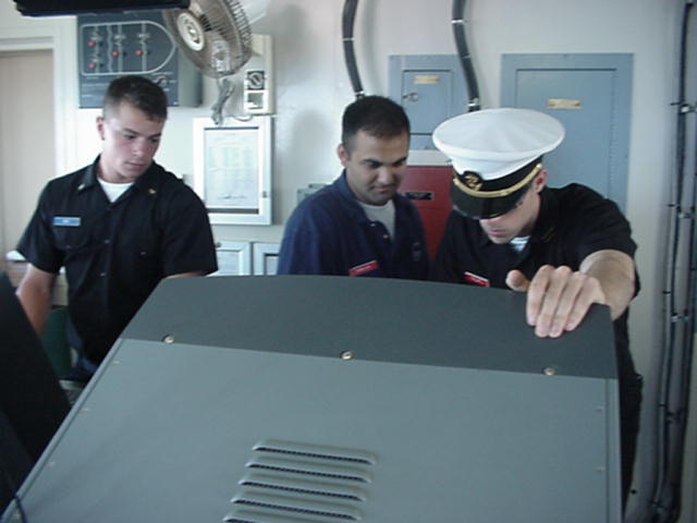
Anchoring drills are wonderfully inclusive training exercises. Everyone from the bridge lookouts to the evaporator watches in the engine room has something important to do. Those who are off watch cannot resist staring at the beach so they are peripherally involved as well. That is what Sea Term is all about.
Late this evening we reverse course, pour on the coal, and steer southeast. See you tomorrow from the Gulf Coast of Florida, near the Dry Tortugas.
QUESTIONS FOR FRIDAY 16 FEBRUARY
MATH:
Two Cadets decided to visit a nature park some distance from the ship. Cadet Hansen rode his bicycle and Cadet Williams rented a car. Cadet Williams departed at 1100, averaging 50 MPH, he arrived at the park at 1400. Cadet Hansen also departed at 1100, traveling at 15 MPH. At what time will Cadet Hansen arrive at the park?
SCIENCE:
Earth is tilted on its axis, which causes variations in the angle at which the sun's rays strike the surface. What does this variation in intensity cause through out the year?
GEOGRAPHY:
The Mississippi River flows from Canada to the Gulf of Mexico passing though 10 states. Name the three northernmost ones.
HISTORY:
The Empire State tied up at the Bienville Street pier, near the French Quarter. Who is that pier named for? Who is New Orleans named in honor of?
ANSWERS FOR THURSDAY 15 FEBRUARY
MATH:
(AB) squared = 6 squared + 8 squared
(AB) sq = 36 + 64 = 100
AB = 10nm
SCIENCE:
Weather occurs in the Troposphere. The other layers are the Stratosphere, Mesosphere, Thermosphere, Ionosphere, and Exosphere
GEOGRAPHY:
French. Acadia, Known today as Nova Scotia, Canada
HISTORY:
Evangeline